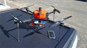
Small Unmanned Craft for Surveying
Credit: 4 PDH Hours
Course Fee: $60.00
34 Pages
Online Course
How it Work!
- Register first and log into your account. Study and take the quiz for FREE until passed.
- After passing the quiz, follow the page, pay for the course and print your certificate.
Course Summary:

In Africa, agricultural entrepreneurs are beginning to be exposed to sUAS technology. However, there is currently a lack of evidence of the benefits outweighing costs for emerging drone-based services, which hinders widespread adoption. Published cases of sUAS use in agricultural mapping scenarios have, to date, remained too limited to provide a sufficiently large body of work to claim that the technology has established itself as a widely- accepted surveying method. After providing an overview of the basic characteristics of sUAS-derived mapping products in agricultural settings, this paper presents two case studies to compare the appropriateness and efficiency of sUAS-supported mapping techniques relative to other established terrestrial survey methods. A cost-benefit analysis of sUAS use of in Osona Village Development and Double DV Ranchette projects is used to exemplify the practical potential of UAV-supported mapping technology in agricultural applications.
It should be pointed out that sUAS technology does not replace conventional surveying methods but provides an additional resource complimenting conventional instruments in the surveyor’s equipment inventory, namely total station and global navigation satellite system (GNSS) receivers. Furthermore, the analysis provided in this course focuses only on those applications, or aspects thereof, in which conventional terrestrial surveys methods are currently accepted as feasible and appropriate. Conventional, manned aerial mapping techniques, LIDAR (light detecting and ranging) surveying and satellite mapping are thus not included in the cost-benefit analysis. Radiometric aspects of sUAS-supported mapping technique have also not been considered in this analysis. This analysis focuses on the spatial or geometric aspects of surveying and mapping.
Learning Objective:
The learning objective of this course is for the student to learn the use of small unmanned aerial systems (sUAS) in aerial mapping applications.
Review the quiz before studying the course.
Course Content
Course Author: Franco F. Davati, P.E
https://www.discountpdh.com/speakerCourse Evaluation
Your opinion matters to us. Kindly share what you found helpful or what could be improved in this course. Please email your comments to fdapdh@gmail.com.
Certificate of Completion of the Course
This course comes with a multiple-choice quiz. You can view the quiz and take the quiz if you are logged in your account. You can take the quiz for this online PDH course as many times until passed. The passing grade is 70% and above. After you pass the quiz simply follow the page, to pay for the course and print your certificate instantly. A copy of the certificate and receipt for this course will always be in your account.
Refund Policy
We offer a 100% money-back guarantee if any of our courses are not accepted by a State Board. All refund requests must include an official denial letter from the State Board. Refunds cannot be issued once a course has been purchased and the certificate has been printed.
This online PDH course can also be used as a continuing education course for the following.
